close
close
close

Enjoy Free 12 Months Maintenance Service

Software

Real-Time Mapping

2D Reconstruction

3D Reconstruction

Sub Categories

Agisoft
Agisoft
1 item
DJI Terra
DJI Terra
2 items
Pix4D
Pix4D
3 items
sidebar:
  • DJI Terra Pro

    DJI

    DJI Terra Pro

    Make the World Your Digital Asset Capture, analyze and visualize your environment with DJI Terra – an easy to use mapping software developed to help industry professionals transform real-world scenarios into digital assets. Plan. Process. Analyze...

  • DJI Terra Advanced

    DJI

    DJI Terra Advanced

    Make the World Your Digital Asset Capture, analyze and visualize your environment with DJI Terra – an easy to use mapping software developed to help industry professionals transform real-world scenarios into digital assets. Plan. Process. Analyze...

  • DJI FlightHub

    DJI

    DJI FlightHub

    QUICK OVERVIEW The ultimate solution for managing your drone operations Ensure all pilots conform to regulatory requirements Manage live operations with real-time live and map views of your remote operations Automatically sync flight logs for...

  • Pix4DFields

    Pix4D

    Pix4DFields

    CAPTURE Collect images using a drone and any standard RGB or a selected multispectral camera like Parrot Sequoia+ & Micasense RedEdge-MX. You can also use a selected thermal camera like FLIR Vue Pro & Zenmuse XT. Use the Pix4Dcapture app to...

  • Pix4Dmapper Pro

    Pix4D

    Pix4Dmapper Pro

    CAPTURE 
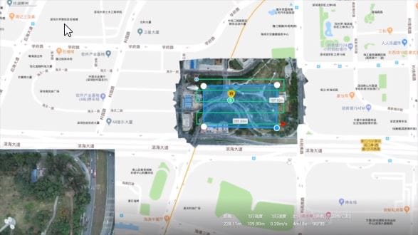
Capture RGB, thermal, or multispectral images with any camera. If using a drone, automate flight and image-data transfer with the free Pix4Dcapture mobile application. DIGITIZE 
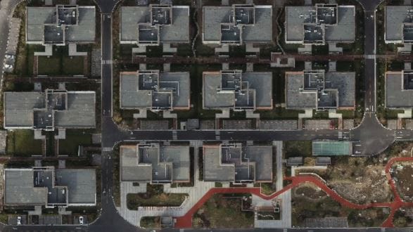
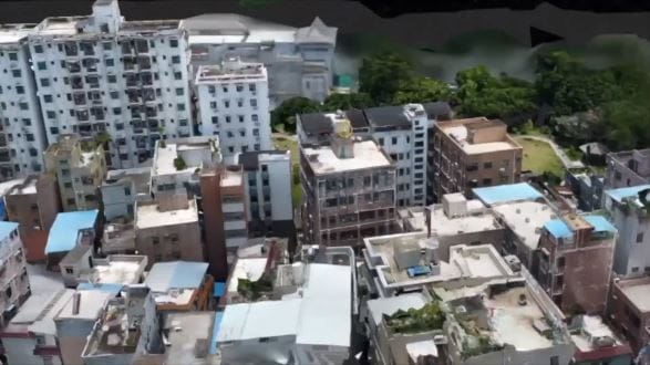
Pix4Dmapper transforms your images into digital spatial models and...

  • Pix4Dreact

    Pix4D

    Pix4Dreact

    Pix4Dreact 2D fast-mapping for emergency response and public safety Capture: Fly your Mavic 2 Pro to capture the images you need. Plan an optimized and automated flight with an app like Pix4Dcapture. Process: Combine large numbers of...

to top