 Malaysian Ringgit


Pix4Dreact
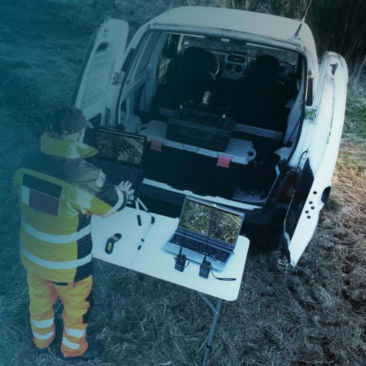
2D fast-mapping for emergency response and public safety
Capture: Fly your Mavic 2 Pro to capture the images you need. Plan an optimized and automated flight with an app like Pix4Dcapture.
Process: Combine large numbers of images in minutes with Pix4Dreact. Create measurable 2D maps either in the field or back at base.
Examine: With Pix4Dreact's simple tools, identify and measure points of interest, mark and evaluate your maps while on the ground to provide powerful data needed to take action.
Share: Export your maps to ensure teams and decision-makers are provided with effective information when it is needed most.
Respond: With up-to-date maps, gain precious time, improve safety, and reduce costs when responding to an evolving situation.
Pix4Dreact creates 2D maps from aerial imagery in minutes. Because when every second counts, up-to-date and reliable information is of utmost importance to teams on the ground.
Simple and intuitive to use, even in complex and stressful situations. Pix4Dreact is developed with public safety and humanitarian aid professionals to meet their unique challenges.
Lightweight enough to work on a mid-range computer in the field. Pix4Dreact doesn’t rely on an internet connection or the cloud for processing.
MAKE SURE YOUR PLANS ARE BASED ON UP-TO-DATE DATA

This image shows side-by-side comparisons of satellite imagery and an up-to-date map created with Pix4Dreact. If your public safety organization was planning simply based on satellite images, the dirt area behind the building may look like an acceptable staging area. Unfortunately, there has been some construction since the satellite has updated. The up-to-date map from Pix4Dreact ensures when you're planning, you won't have any surprises like a new wall or an additional 2000 square feet of parking lot to deal with on the fly.
The full map of this building and its near surrounding area took a total of 23 minutes to create, from pulling the drone (DJI Mavic Pro) out of the bag to the final map export. All of that while also maintaining complete control of the data, which is not uploaded to or processed in the cloud.
Compare Pix4Dreact & Pix4Dmapper
Orthomosaic output from react and mapper with the exact same data set.
Click and slide the blue slider to compare two images:
Dataset captured with DJI Mavic 2 Enterprise Dual (RGB only) with Smart Controller using DJI Pilot App.
In the comparison above, you can see that Pix4Dmapper stitches the images together much more accurately, giving much straighter edges and lines. Pix4Dreact has some rough edges, but for most first-responder situations is accurate enough for quick action. While mapper's map has incredible detail, it took 5 hours and 52 minutes to process the map and be able to export or interact with the map. In a tight (or simply time-sensitive) situation, the Pix4Dreact map is adequate for action and took a mere 16 minutes to process the data.
